Expert Drone Solutions
High-precision aerial intelligence tailored for property management and construction stakeholders.
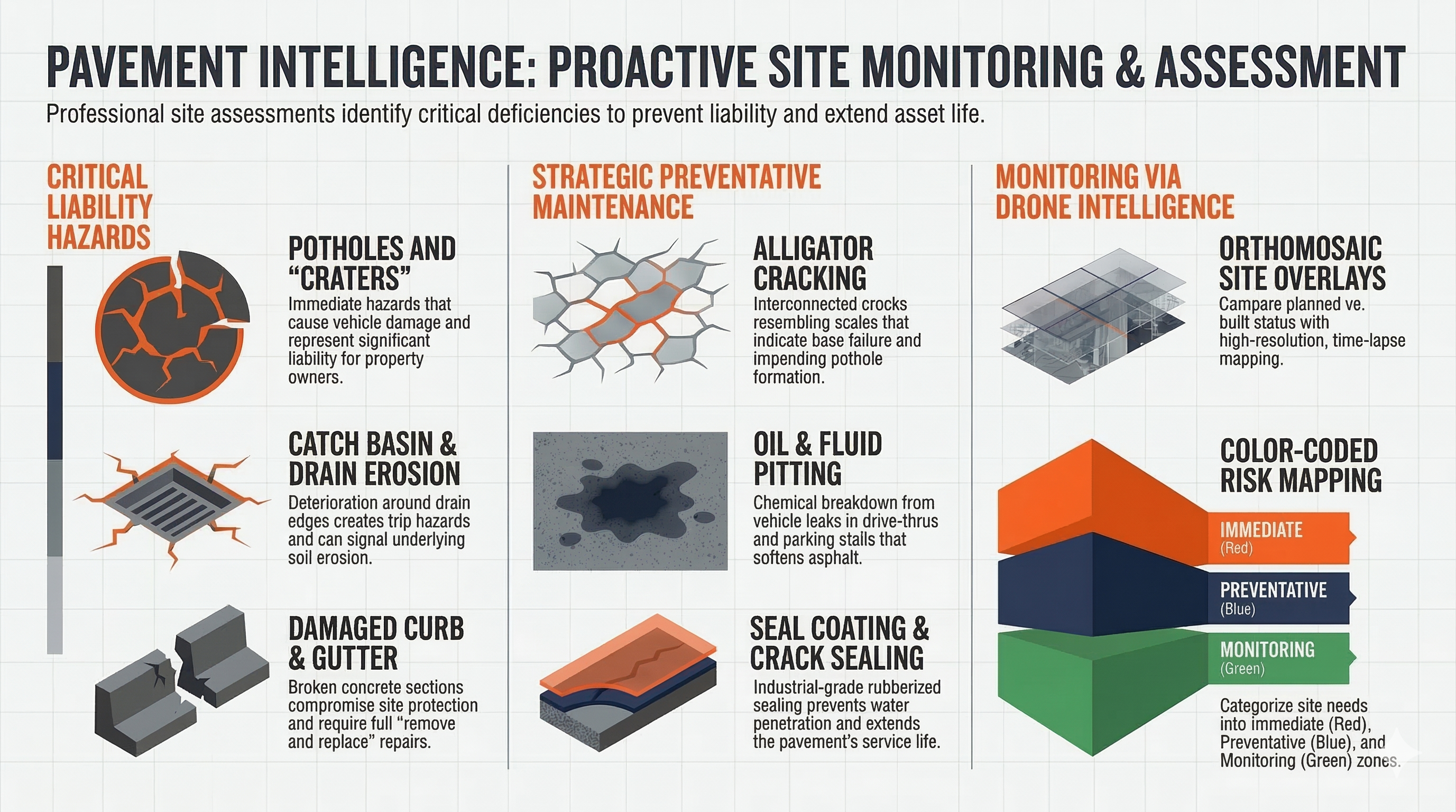
Parking Lot Surface Analysis
Avoid costly surprise repairs with high-resolution visual data. We provide automated surface condition reporting using AI-assisted defect detection. From cracks and potholes to faded striping, we map every observation with GPS accuracy to help you prioritize your maintenance.
- ✓ Detailed Defect Heatmaps
- ✓ Accessibility Visibility Checks
- ✓ Visual Condition Documentation
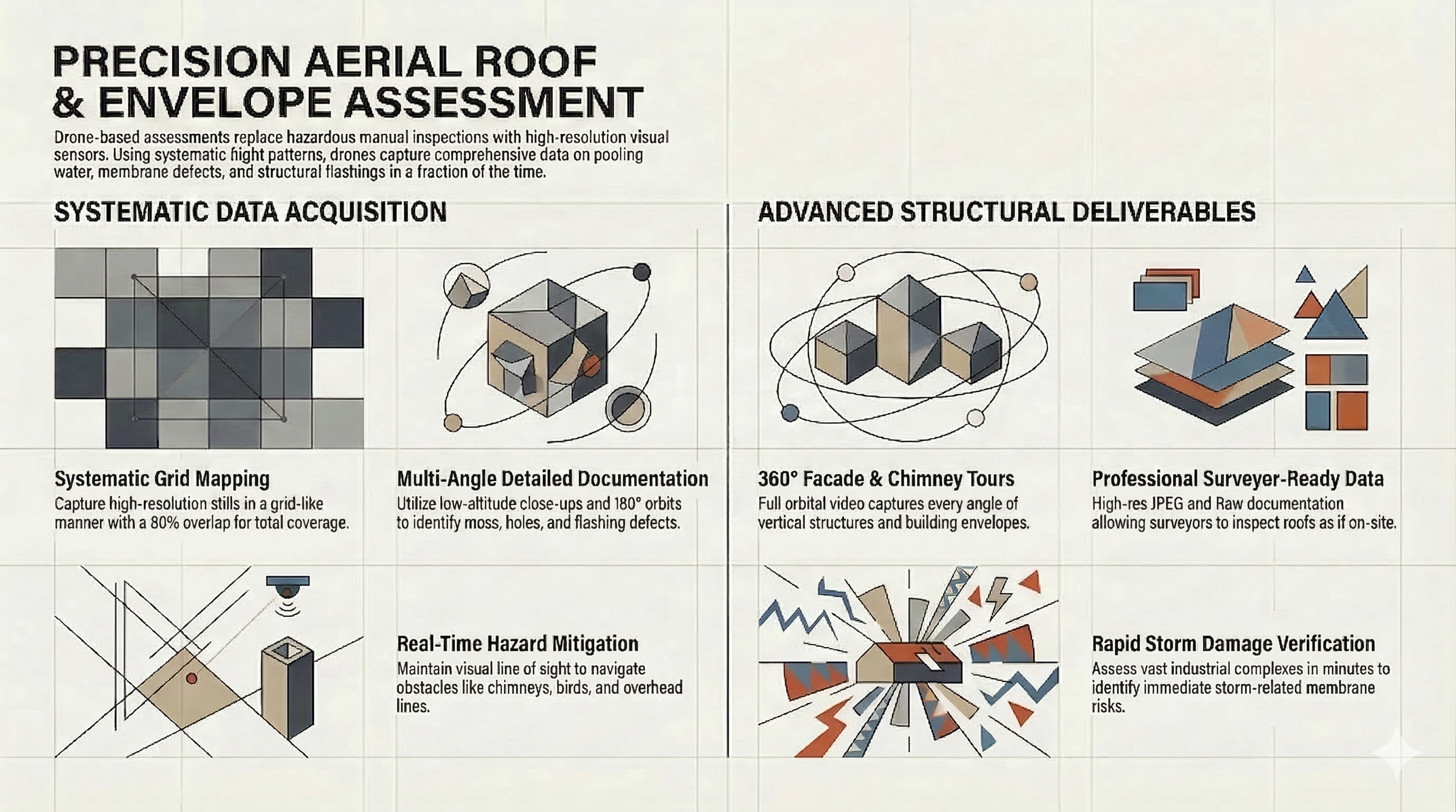
Roof & Envelope Assessment
Eliminate the risk of manual roof walks. Our high-resolution visual sensors identify pooling water, damaged flashings, and membrane defects across vast industrial complexes in minutes.
- ✓ High-Res Visual Documentation
- ✓ 360° Building Facade Tours
- ✓ Storm Damage Verification
Construction Progress Monitoring
Keep your project on schedule and your stakeholders informed. We provide weekly or monthly site updates that allow you to compare planned vs. built status through orthomosaic maps and 3D models.
- ✓ Time-Lapse Site Overlays
- ✓ Volume & Earthwork Measurements
- ✓ Remote Site Coordination

Ready for a preliminary site review?
Provide your property address, and we'll conduct an initial airspace and scouting assessment.
START YOUR INTAKE